CALIFORNIA REGIONS
INQUIRY PROJECT: EAT IT MAP!
Due date: Thursday, October 7th
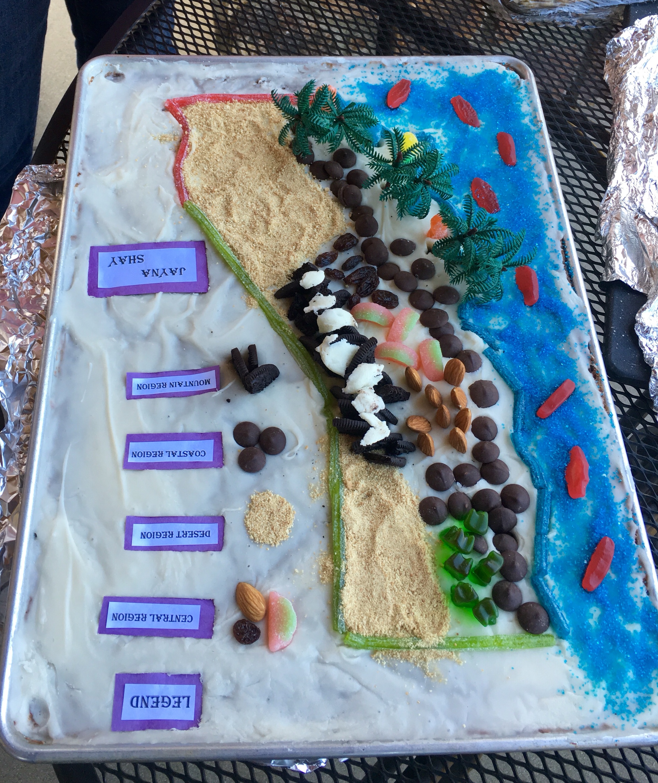
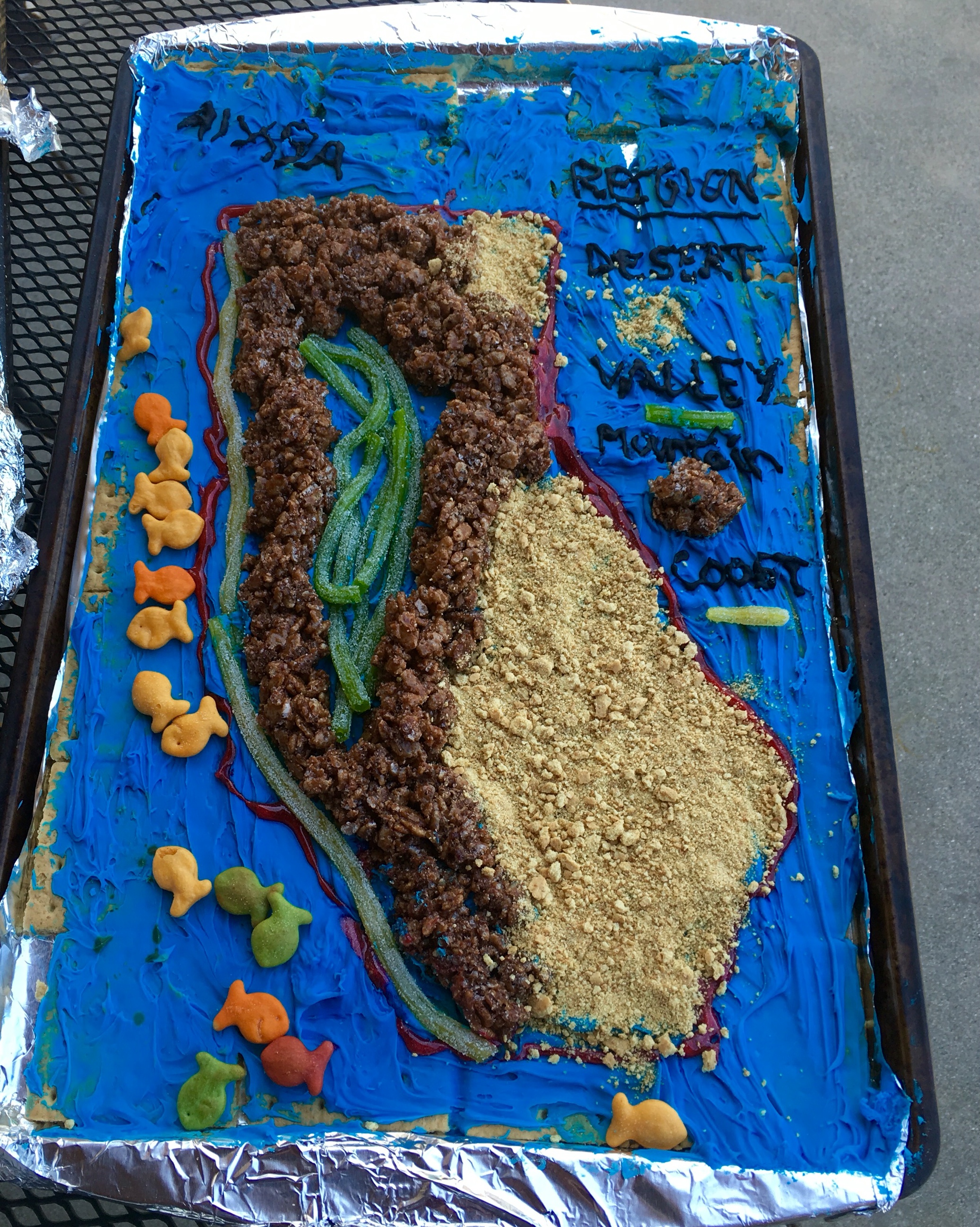
Sample Projects-
https://userfiles-secure.educatorpages.com/userfiles/destinedfortriumph/IMG_0078.JPG
https://userfiles-secure.educatorpages.com/userfiles/destinedfortriumph/IMG_0079.JPG
https://userfiles-secure.educatorpages.com/userfiles/destinedfortriumph/IMG_0083.JPG
In our first unit of Social Studies, we are learning about the four regions of California. Here is a fun, tasty project your child will be doing to culminate our unit.
Materials: Use whatever items you have around the home.
Here are some material ideas to get you started: a cookie sheet or a tagboard covered with aluminum foil (15”x10”), graham crackers, icing, sprinkles, various candies, vanilla icing, blue sprinkles, yellow sprinkles, green food coloring, mini marshmallows, cereal, dried fruit, Hershey kisses, flower-shaped sprinkles, red licorice, and miniature candy bars.*For students with food allergies, beans, pasta, and paint can be used. Including other non-food items of your choice.
Instructions:
- Use the California Regions Map (attached) as a model to use for your map.
- Use a tagboard or baking sheet covered with foil for your foundation. Suggestions-You can line the sheet with graham crackers (or a big baked sugar cookie works too). You can also cover the graham crackers (or big baked cookie) cut into the shape of California with an even layer of white cake icing. This can be your base.
- Use icing, candies, etc; to draw and outline the shape of California. You can add bordering states for an extra touch.
- Use edible items (examples listed under materials) to show the 4 major regions of California (Mountains, Central Valley, Coast, and Desert) and the ocean. Be creative.
- Include a legend on the map that shows the symbols/colors used for each region and label each section to show its location.
Project Checklist (to be shared on the Flipgrid video
- *Identify the state’s four geographic regions.
- *Label the oceans, and key cities (one for each region), including your own.
- *Mark the map with symbols to show one natural resource per region. Use toothpicks to make mini flags with pictures for each resource.
- *Write descriptions on index cards about the geography of each region and how it affects the lives of the people who live there. (3-4 sentences per region). This portion will be submitted in class. It can be typed also.
- *Flip Grid Presentation- share a 3–5-minute video sharing your map and at least 4 facts. (1 fact per region).
"Eat it" Map Grading Sheet
Total points: 200
Region Map- I have created a map that shows all four regions of California, the ocean, key cities, and natural resources properly identified. My index cards reflect the descriptions for each region in detail. (25 points for each region). 100 points
Points Earned_______________/100
Legend- I have placed a legend on the map to show the symbols/colors I used for each region and also labeled it directly on the map. 20 points
Points Earned_______________/20
Flipgrid Video Presentation- sharing 4 detailed facts you learned about the regions. 30 points
Points Earned_______________/30
Completion of the project- I used neatness and creativity in completing my map of California 50 points
Points Earned_______________/50
Total Points Earned________________________/200